
Please note: This site contains links to websites not controlled by the Australian Government or ESA. Read more in the Terms of Use.
Reading and navigating through songlines
Students explore the interplay between songlines and the land, understanding how these knowledge systems facilitate navigation, trade, ceremony, and social interaction.
- Resource details
- Year level
- Year 3
- Purpose
- Teaching resource
- Strand
- Space
- Topic
- Position and location
- Audience
- Teachers
- Australian Curriculum code
- AC9M4SP02
- Numeracy progression
- Positioning and locating (P4)
- Publisher
University of Melbourne
- Copyright
© The University of Melbourne – Ngarrngga, 2026. Free-for-education.
Related resources
-
Position and location: Year 3 – planning tool
This planning resource for Year 3 is for the topic of Position and location.
Resource details -
Super Maths Quiz
The Super Maths Quiz uses random generation to create endless quizzes, allowing your students to revise core concepts at the start of each mathematics lesson.
Resource details -
Street maps
In this unit, students use street maps as the context to learn about coordinates and grid references.
Resource details -
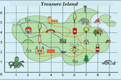
Treasure island
Introduce a coordinate system using numbers to represent locations on a map.
Resource details -
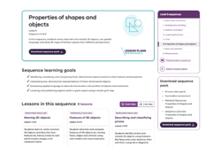
Properties of shapes and objects (9 lessons)
In this sequence of 9 lessons, students name, describe and classify 3D objects, use spatial language, and draw 2D maps of familiar spaces from different perspectives.
Resource details