Please note: This site contains links to websites not controlled by the Australian Government or ESA. More information here.
Map it
This unit explores the mathematics of maps, including scale, coordinates and compass bearings.
Additional details |
|
| Year level(s) | Year 4 |
|---|---|
| Audience | Teacher |
| Purpose | Teaching resource |
| Format | Web page |
| Teaching strategies and pedagogical approaches | Differentiated teaching, Mathematics investigation, Explicit teaching |
Curriculum alignment |
|
| Strand and focus | Space |
| Topics | Position and location |
| AC: Mathematics (V9.0) content descriptions |
AC9M4SP02
Create and interpret grid reference systems using grid references and directions to locate and describe positions and pathways |
| Numeracy progression |
Positioning and locating (P4)
|
Copyright details |
|
| Organisation | New Zealand Ministry of Education |
| Copyright | © New Zealand Ministry of Education. Creative Commons BY 3.0 NZ. |
Related resources
-

Navigating our way through country
Investigate a map that includes a key to the map symbols, a scale for distance units and a scale for area measurement units.
Resource details -

Position and location: Year 4 – planning tool
This planning resource for Year 4 is for the topic of Position and location.
Resource details -

Super maths quiz
The Super Maths Quiz uses random generation to create endless quizzes, allowing your students to revise core concepts at the start of each Mathematics lesson.
Resource details -

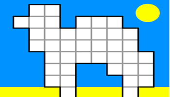
Cover the camel
In this resource, students describe their strategies as they use positional language to cover a camel shape with particular pieces.
Resource details
